Funded Projects
The Vegetation and Landscape Ecology (VALE) lab is headed by Janet Franklin. Researchers at VALE examine patterns and dynamics of terrestrial ecosystems at the landscape scale, as well as the impacts of human-caused landscape change on terrestrial plant communities. For more information on VALE, see here
The lab for Spatial Analysis in the Social Sciences (SASS) is headed by Serge Rey. Researchers at SASS examine patterns of urban spatial structure and their interactions with the dynamics of economic, demographic, education, public health, and other social systems. Their work applies urban data science, spatial econometrics, and geospatial statistics to pressing issues in social science and public policy.
A selection of current and recently funded COGS projects is listed below. Use the buttons to filter between Labs
*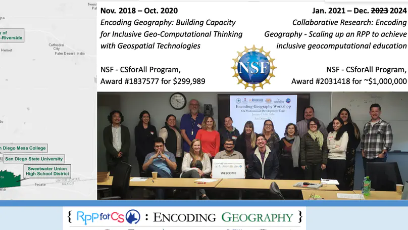
The geospatial services industry is a profitable and rapidly growing field; however, employers find it difficult to hire scientists with expertise in both geography and computer science. The limited availability of training opportunities in both computer science and geography has created a shortage of workers with the necessary knowledge and skill sets for those jobs. Through a Researcher-Practitioner Partnership (RPP), The Association of American Geographers (AAG), in collaboration with Texas State University, the University of California-Riverside, San Diego State University, the California Geographic Alliance, Sweetwater Union High School District, and San Diego Mesa College, will create an inclusive high school to college curriculum pathway that bridges concepts in computer science and geography. This RPP will support the development of a curriculum that is conceptually rigorous, inclusive, and culturally relevant. It will also produce a replicable approach for teaching geocomputation that is accessible and motivational for all learners.
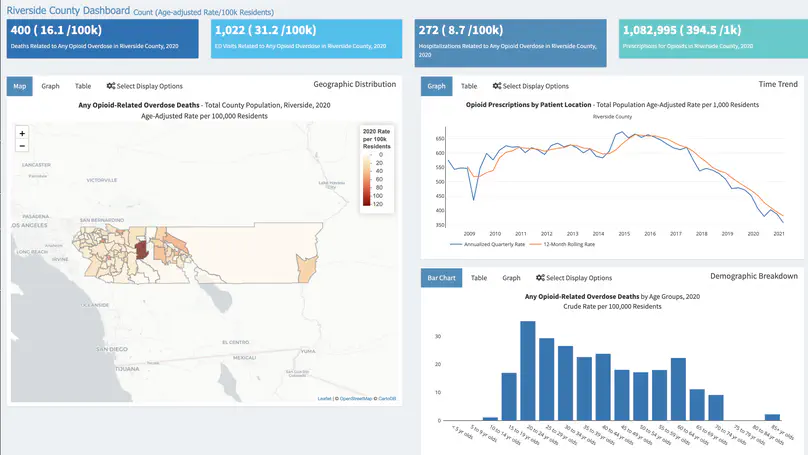
Nationally, narratives of opioid overdose as a predominantly White suburban crisis tell only a partial story, overshadowing the importance of local geosocial contexts in producing overdose disparities in marginalized and underserved communities. The goal of this project is to develop an innovative Ethno-Geographic Information System (EGIS) combining ethnography with spatial analytics to characterize opioid overdose and guide resource allocation and research to address overdose disparities in underserved communities. Our research will provide an innovative new method, EGIS, to serve as a foundation for developing and testing community-level interventions to reduce overdose incidence and mortality in subsequent R01 grant proposals, and will provide a new tool for use by communities around the country to refine and optimally target efforts to reduce opioid overdose disparities.
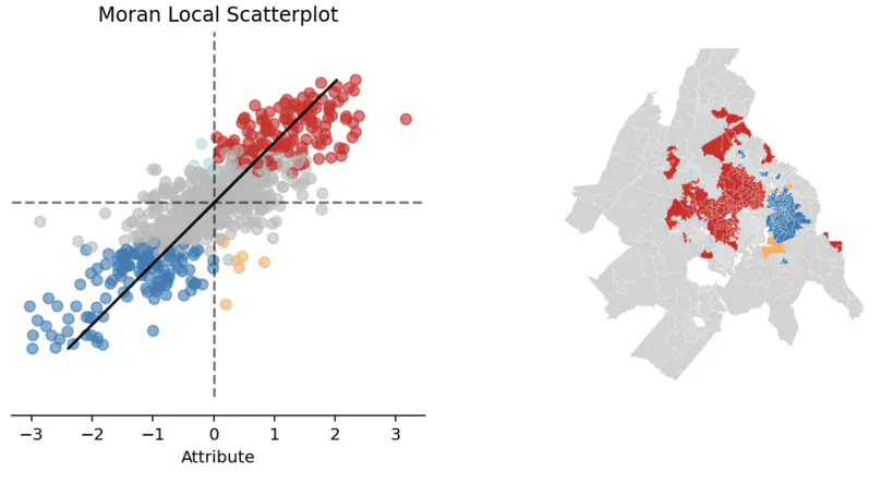
This project enhances the geosnap software package to assist research on the relationship between neighborhoods and educational outcomes. Its goal is to improve the analytical capacity of educational researchers supporting Black, Latino, and low-income students by making advanced spatial methods easier to adopt.
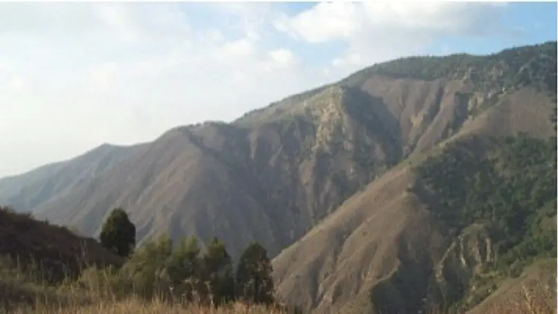
With Helen Regan (PI) at UC Riverside, Janet Franklin, Brooke Rose and Santiago Velazco are identifying the elements of plant biodiversity in California that are most vulnerable or most resilient to the interacting threats of climate change, land use change and wildfire in the coming decades. The vulnerability of a plant species to this triple threat depends on their distribution (biogeography) in relation to these threats, as well as their species traits. Plants may be long or short lived (redwood trees versus poppies), may escape habitat fragmentation and loss because their ecological niche places them in locations undesirable for development, or not, and they may have traits that allow them to recover their populations following fire (fire-stimulated seed germination, or resprouting from underground parts). In a changing environment, plants can only move (migrate) out of harm’s way intergenerationally, via seed dispersal. Our project will identify the general aspects of biogeography (where) versus species traits (how) that confer more or less vulnerability to California flora under global change in the coming century as California’s human population grows and the climate warms. We are doing this using simulation modeling to project the population growth or decline for a wide range of plant species in California.
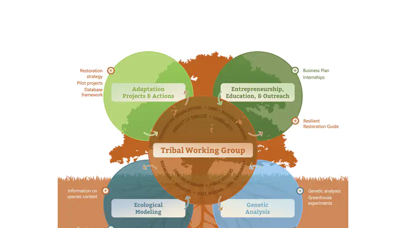
The goal of the project is to preserve plant species and ecosystems that enable the continuation of native tribal cultural practices. Currently, some of these species are facing threats including hotter temperatures, prolonged drought and increasing urbanization. ‘Many plants that are integral to tribal tradition and spirituality are also key for maintaining biodiversity in this region,’ said Helen Regan, a professor in UC Riverside’s Evolution, Ecology, and Organismal Biology Department, and co-principal investigator of the project. ‘Everyone benefits from ensuring the survival of these species.’
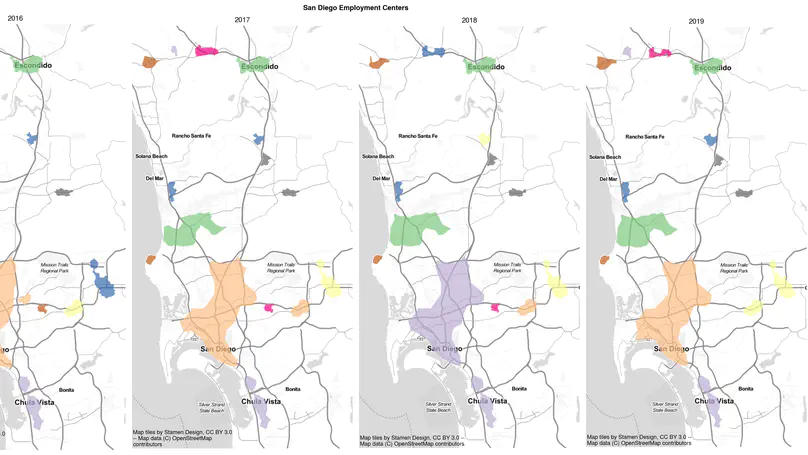
This project develops a new body of spatial analytic methods for data intensive research in the social and behavioral sciences. Through an interdisciplinary team of geographic information scientists, public policy scholars, and computer scientists, this project provides researchers with the next generation of scalable, high performance spatial analytical techniques. The research targets existing challenges that have hindered the more extensive and intensive utilization of geospatial data from the US Census, American Community Survey, and social media through a combination of new computational algorithms for regionalization, new approaches to computational inference, and use of scalable spatial and spatiotemporal data management techniques.
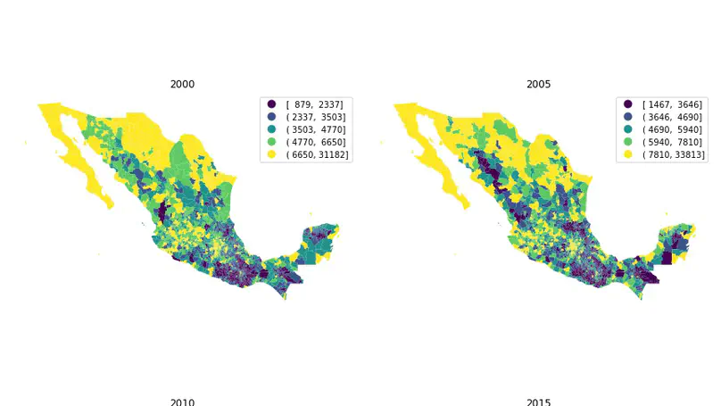
This research project will comparatively analyze the dynamics of regional inequality in the United States and China using recent developments in geographic information science. Because the investigators will focus on core-periphery structure, place mobility, and scalar effects, this project will significantly improve basic understanding of spatial inequality. This project will advance knowledge about the dynamics of regional income inequality in a number of different ways. It will provide a systematic study of the multi-scalar nature of regional inequality, thereby providing a clearer picture of the dynamics of regional inequality and its relationship to scale. It will provide new insights about place mobility and about the core-periphery structure in regional development, and it will provide new perspectives regarding the role of geography in regional inequality. Project findings should prove valuable to domestic and international organizations, such as non-profit organizations and the U.S. and Chinese governments, giving them improved understanding of inequality and facilitating the development of more informed policies that address development issues in equitable ways.
